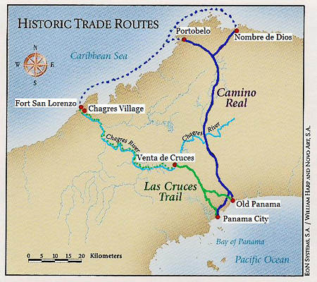
The Camino Real
The Isthmus of Panama is only about 40 miles across and at the time of the Spanish occupation in the 16th century, the Chagres River was navigable by small ships and boats
as far as Venta de Cruces, 31 miles upriver, so this together with the Camino Real ("Royal Road") built by the Spanish, formed one of the major trade routes across the Isthmus from the Caribbean to the Pacific coast.
Aware of its strategic importance, Emperor Charles V of Spain instituted the first investigation in 1534 into a canal between the Chagres River and the Pacific but in the centuries that followed,
various routes across the Isthmus were considered and a number of schemes proposed. It wasn't until 1879 that a French Company was formed, led by Ferdinand de Lesseps (right), builder
of the hugely successful Suez Canal of 1869.
The French Canal
Excavations began in 1880 on a sea-level canal following the river valleys but progress was painfully slow and dogged by frequent landslides in the heavy tropical rains,
while the workforce was being decimated by malaria and yellow fever, a major problem which current medical knowledge was unable to solve. Over 6,300 lost their lives and although a certain amount of infrastructure was established,
poor planning, inadequate resources and financial scandals finally drove the Company into bankruptcy. De Lesseps died in 1894, aged 89.
Panamanian Independence & the American Canal
The United States had long seen the strategic importance of a canal through Central America but the opportunity to
purchase the assets of the collapsed French company eventaully persuaded President Theodore Roosevelt to opt for the French route. But it was American encouragement
of the independence of Panama from Colombia in 1903 that finally enabled the United States to agree a Treaty granting them a strip of land in perpetuity, 10 miles wide across the Isthmus.
Referred to as "The Canal Zone", its neutrality would be guaranteed by the United States and it would be administered by the Panama Canal Commission (a US Government body).
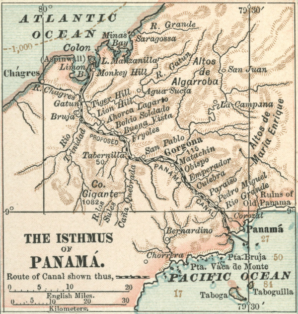
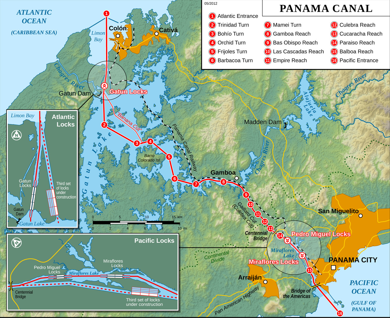
Map of the American Canal
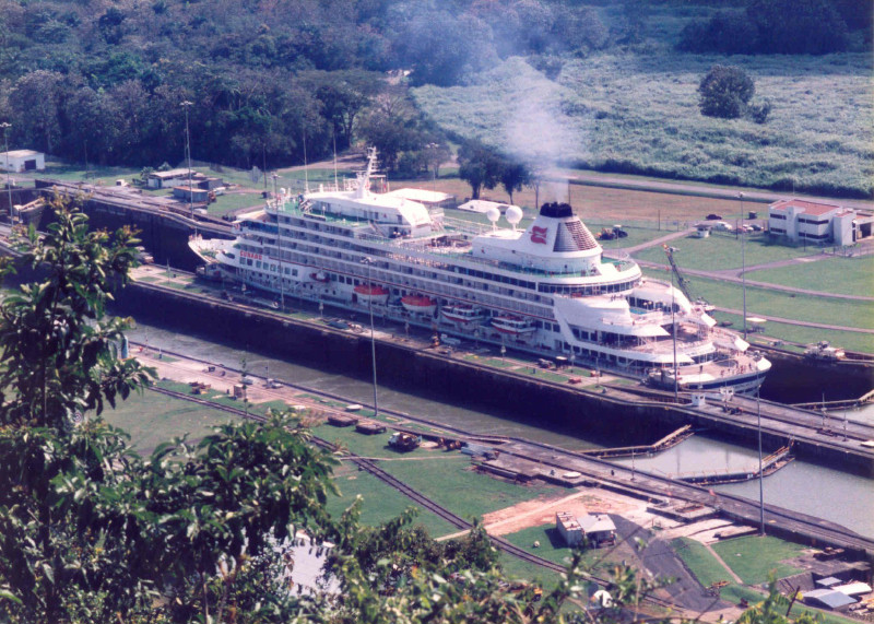
Building one of the enormous locks
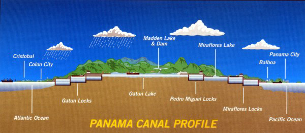
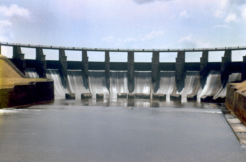
Gatun Lake & the Gatun Dam The largest dam in the World in 1914
Gatun Lake is a 164 sq mile (425sq km) artificial reservoir, formed by the damming of the Chagres River. Together with a system of vast locks, it was this fundamental
American idea that in 1904, turned the concept of a canal from a disaster into reality.
At the time it was completed, Gatun Dam was the largest in the world, creating the largest man-made lake in the world. The dam would generate enough power to operate the canal, indeed for the entire
Canal Zone, while the lake would provide water to operate the locks. In turn, the high tropical rainfall would maintain the level of the lake. It was an almost ecological solution.
The construction of the Canal was under the overall leadership of US Army Engineer John Frank Stevens while George Washington Goethals, another US Army Engineer, became Chief Engineer and drew praise for his expertise in
the construction of the great locks, the likes of which had never been seen before.
Meanwhile, William Gorgas was appointed Chief of Health; already successful in arresting malaria by the control of mosquitos in Florida, he also undertook the sanitation and hospital improvements necessary to erradicate yellow fever.
The Canal was inaugurated on 15th August 1914.
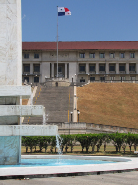
(left) The Goethals Monument and Canal Administration Building (1914)
Tensions in Panama & the Treaty of 1977
The Panamanians were never that keen on the terms of the original Treaty of 1903 but their priority at the time was Independence. So in 1935, aspects of the Treaty were reviewed at the time of construction of the Madden Dam higher up the Chagres River.
This second dam today works in conjunction with Gatun Dam to maintain Gatun Lake at a satisfactory level to supply the locks.
Panamanian unrest continued however and in January 1964, riots resulted in a number of deaths and the breaking of diplomatic relations between USA and Panama, until
mediation by the Organisation of American States enabled talks to commence. But it was Panama's General Omar Torrijos Herrera who internationalised the issue, leading to
the Torrijos-Carter Treaty of 1977, guaranteeing the Canal's neutrality and setting out a transition period for its handover to Panama on 31st December 1999.
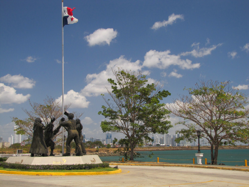
(right) The Monument to the Martyrs at Amador, Panama
The Panama Canal Expansion Project
The maximum size of ships passing through the Canal are called "Panamax" ships but with the increase in the number of vessels exceeding the "Panamax" standard, the Canal
has come under increasing pressure to provide a solution. In addition, the amount of water used for each vessel transit results in a limit on the maximum number of transits possible
and it was estimated that this level would be reached by 2012.
Two new sets of locks (see Map above) are being constructed alongside the locks at Gatun and Miraflores, their design utilising an ingenious water-conservation system which saves
60% of the water used during each transit in special water-saving basins.
Whereas the existing locks are 1,050ft long and 110ft wide, the new locks will be 1,400ft long, 180ft wide and will permit ships to pass with a draft of up to 60ft.
The original locks will continue to operate beside the new ones and completion of the Expansion Project is scheduled for August 2014, the 100th Anniversary of the inauguration of the Canal.
(right) A representation of the new locks and water-saving basins at Miraflores
The best way to see the working of the Panama Canal is to follow a day-long passage through it, which
we first did aboard my favourite Sagafjord in 1994.
Saturday 10th September 1994 The Panama Canal - Balboa to Colón
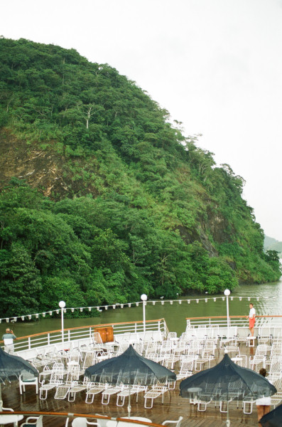
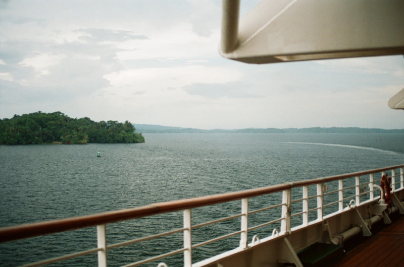
From a position 6 degrees North, the closest we had ever been to the Equator, we turned north into the Bay of Panama and by 7.00am, we were among dozens of
ships at anchor off Balboa, the entrance to the Panama Canal. In the distance, we could see the skyscraper skyline of Panama City.
Panama City Skyline
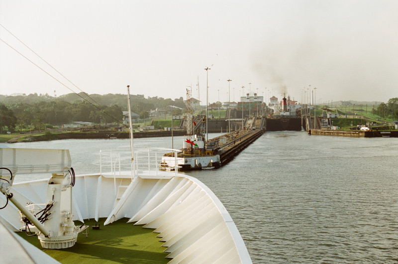
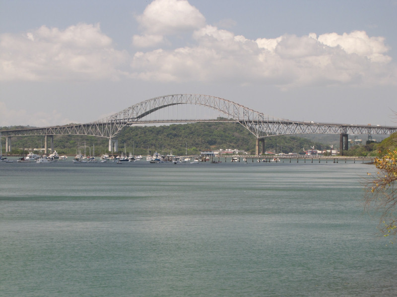
The Canal Entrance The Bridge of the Americas
Bridge of the Americas & the Pan-American Highway
Approaching the Miraflores Locks
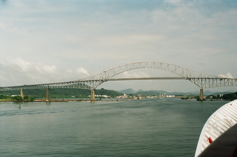
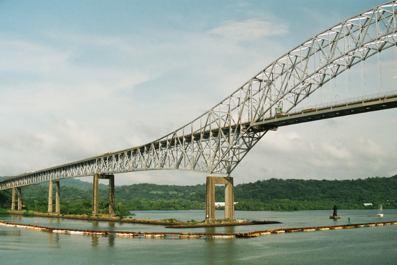
The Pacific entrance to the canal is marked by the 1,128ft (344m) steel arch of the Bridge of the Americas, opened in 1962 and carrying the Pan-American highway between
North & South America.
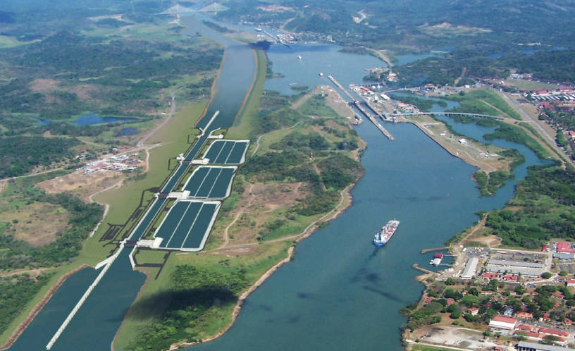
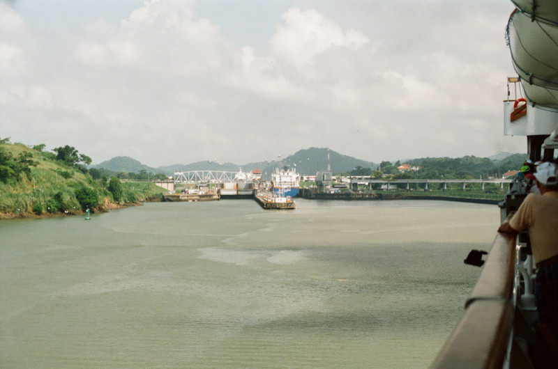
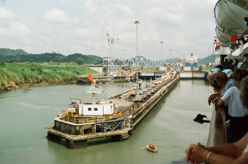
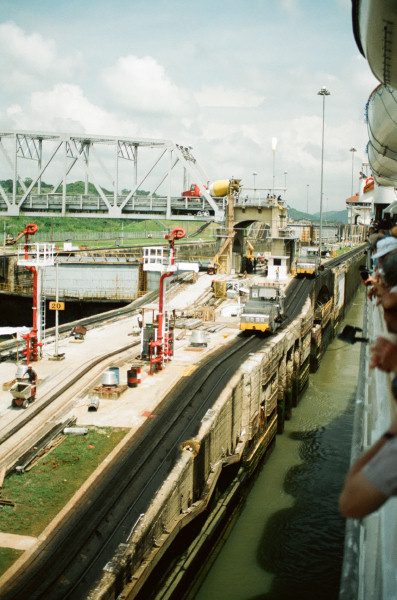
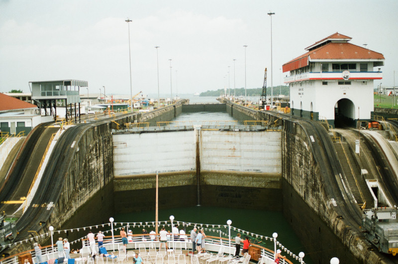
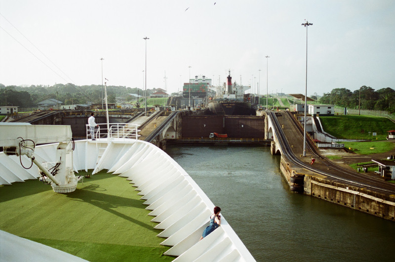
Passing beneath the bridge, we come to the first set of locks, the Miraflores Locks, where the ship is raised 54ft (16.5m) in 2 stages, then about a mile further on
at the Pedro Miguel Locks, the ship is raised another 31ft (9.5m) in one go.
(right) Cross-section of the Panama Canal
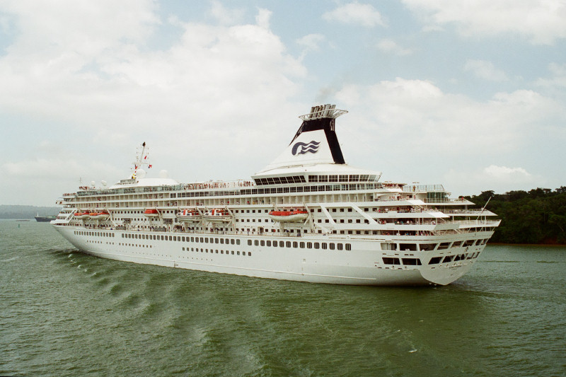
Each lock chamber is 1,050ft long by 110ft wide (320m by 33.5m), so although it looks a tight squeeze, for Sagafjord there's quite a bit of room to spare. However, Cunard's
Queen Elizabeth 2 is 963ft long and when she passes through here, she has barely 2ft 6in to spare on each side. Merchant ships built to the maximum size to pass through the canal are called "Panamax Ships".
Miraflores Locks another ship ahead
Moving between lock chambers
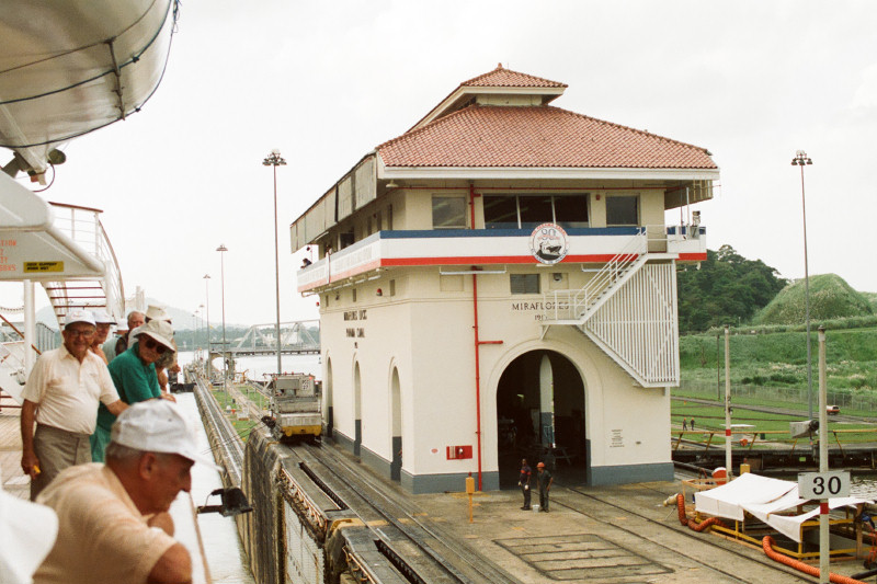
Lock Control Center at Miraflores Locks
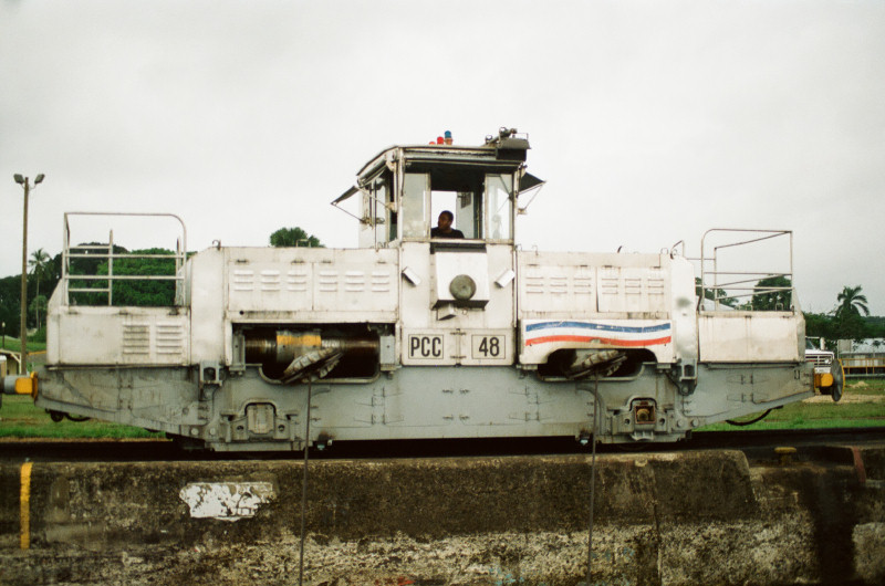
An Electric "Mule" helps guide the ship
While most ships proceed under their own power, they are hooked-up to and controlled and guided by powerful electric locomotives, affectionately called "Mules" because they travel along with the ship,
climbing up (or down) on a "Rack-and-Pinion" track system laid alongside each lock.
The Panama Canal - according to Andrew....
It was at about this point, barely out of the Miraflores Locks, that the sun came out and Andrew headed for the sun-loungers. As we entered the Pedro Miguel Locks and the vast gates closed behind the stern of the ship
(and the sun-deck!) I railed with him that the Panama Canal was one of the "Seven Wonders of the Modern World" and that he wasn't watching any of the fascinating activity going on around us; to which he uttered those immortal words, "Well, once you've seen one lock, you've seen them all!"
Having been raised 85 feet (26m) above sea-level, ships then pass through the mountainous region known as the Continental Divide in a section called the Culebra Cut, which had to be dug and blasted
through the mountains in a major feat of engineering taking 7 years to complete. It was renamed the Gaillard Cut in 1915 in honor of the US Army engineer in charge of the works.
Gaillard Cut (The Culbera Cut & Continental Divide)
Gatun (artificial) Lake 164 sq miles (425 sq km) 85ft (26m) above sea-level
Gatun Locks (the Caribbean Side) With 3 lock chambers & gates varying 47-82ft in height
After crossing Gatun Lake, we then reached Gatun Locks, where the ship was lowered 85ft back to sea-level in a set of 3 locks, finally exiting
the canal at Cristobal, now part of the port of Colon.
Some Panama Canal Facts & Statistics (as at 1994) 1. The Canal was built by the USA & opened on 15th August 1914.
2. It is 48 miles long (77.1km) and takes 9 hrs (approx) to transit.
3. The Canal is administered by the Panama Canal Commission,
within the Canal Zone, over which the USA still exercises control.
4. Under the Canal Treaty of 1979, the USA will finally hand-over
control of the Canal to Panama on 31st December 1999.
5. 35-40 ships pass through the Canal each day and for each one,
roughly 52 million gals of water flow out of Gatun Lake into the sea.
6. The 80 electric "Mules" cost $1.2m each when replaced in 1990
(the previous steam-locomotives cost $115,000 each in 1964)
7. The Toll for passage is currently $2.21 per gross registered ton
(so Sagafjord's bill today was about $54,000 or $90 per passenger)
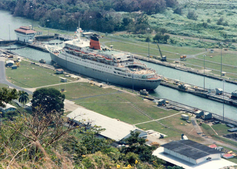
(right) Sagafjord in Gatun Lock (Previous Ship photo)
Two years later, we made another transit but this time going the other way aboard Royal Viking Sun in 1996.
Thursday 26th December 1996 The Panama Canal - Colón to Balboa
Boxing Day or not, today I was up at 6.00am for early breakfast, because by 7.00am we were approaching the Gatun Locks at the entrance to the Canal.
(left) Approaching the Canal entrance from the Caribbean
Two years ago aboard Sagafjord, we had passed through the Canal but in the opposite direction. This time at Gatun Locks, our ship was raised 85ft in 3 stages,
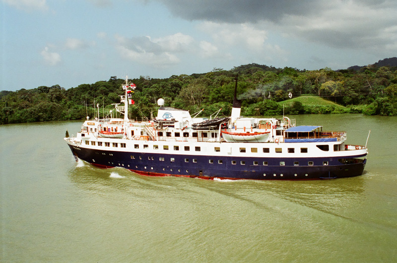
the entire process taking nearly 3 hours. Each lock chamber is 1,050ft long by 110ft wide (320m by 33.5m) and merchant ships built to the maximum size capable of passing
through the canal are called "Panamax Ships".
7.00am Gatun Locks
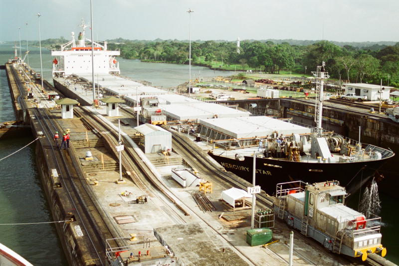
Gatun Locks Tanker "Mercury Star"
Canal Cross-Section Caribbean/Atlantic to Pacific
Royal Princess (1984) 44,348grt - in Gatun Lake
Crossing Gatun Lake, 85 feet (26m) above sea-level, ships then pass through the mountainous region known as the Continental Divide in a section called the Culebra Cut, which had to be dug and blasted
through the mountains in a major feat of engineering taking 7 years to complete. It was renamed the Gaillard Cut in 1915 in honor of the US Army engineer in charge of the works.
Gaillard Cut The Continental Divide
Linblad Expeditions' "Polaris" (built in 1960)
Miraflores Locks Panamax Vessel "Ever Repute" entering the other lock
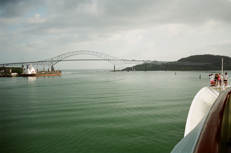
4.00pm Bridge of the Americas & the Pacific beyond
At the Pedro Miguel Locks, the ship was lowered 31ft (9.5m) in a single lock, before progressing towards the Miraflores Locks,
where the ship was lowered another 54ft (16.5m) in 2 stages, finally emerging within sight of the 1,128ft (344m) steel arch of the Bridge of the Americas,
opened in 1962 and carrying the Pan-American highway between North & South America.
We finally left the Canal around 4pm, the entire transit having taken a total of 9 hours.
(left) Royal Viking Sun in the Canal (A Previous Ship photo)
It would be more than 16 years before we would return to the Panama Canal, by which time the Americans had gone and it was fully under the control of the Panamanian Authorities.
This time however, would not involve a full transit but a day-visit only, from the Caribbean port of Colon.
Sunday 17th February 2013
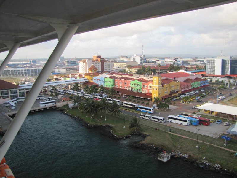
Colón, Panama
Founded in 1850 during the North American "Gold Rush" as the terminus of the new Panama Railroad, the city of Colón has since grown to engulf
its neighbour Cristóbal; "Cristóbal Colón" is "Christopher Columbus" in Hispanic.
Andrew & I passed through the Panama Canal in 1994 (south-north) & in 1996 (north-south) but Lesley & Peter had not seen it before, so today's tour
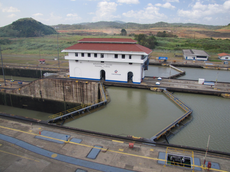
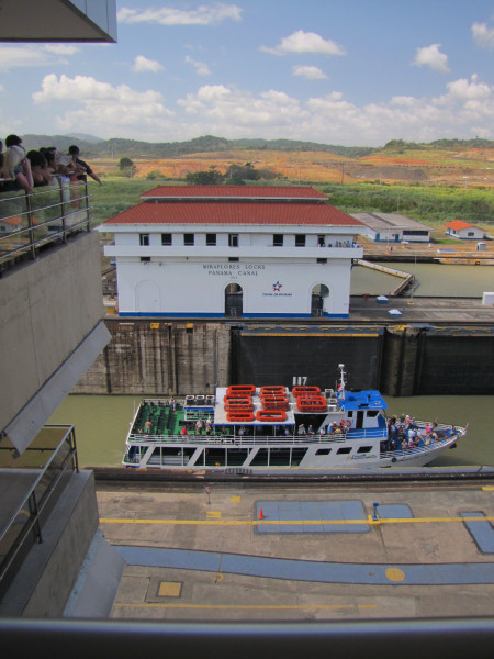
was to the Miraflores Locks Visitor Center.
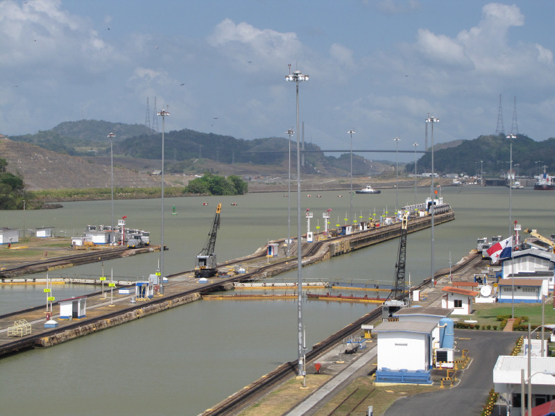
Miraflores Locks from the Visitor Center (left) Toward the Pedro Miguel Locks & Centennial Bridge
(right) Control Building with Expansion Project works behind
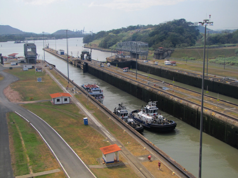
Miraflores Locks A pleasure-boat passes through the lock
Here we watched the working of the locks at close quarters, although we had just missed a tanker passing through and there were no large ships going
through while we were there. We could also see earthworks in the distance, where they are building the new larger locks as part of the Canal Expansion Project
due for completion in 2014, in time for the Canal's 100th Anniversary. There was a small museum but the Visitor Center was very crowded and the 3-D film in its theatre was a disappointment and not worth queuing for.
Lock Control Center Visitor Centre Mock-up
Pacific Canal Entrance The Bridge of the Americas
Goethals Monument & Canal Administration Building (1914)
The Martyrs' Monument with Panama City in the distance
The rest of the excursion involved a tour of the Adminstration Zone and Fort Clayton, one of a number of Army bases built and manned by the United States from 1910 to 1999
to guard the Canal Zone, until the bases and the Canal were finally passed to the Panamanians on 31st December 1999.